

Maine's almighty analog oracle
Or why I smashed my GPS on the sidewalk


It felt so good. I didn’t hesitate. I’d already fantasized about doing it for years and, on Tuesday, I finally did. I smashed my motorcycle’s Garmin XT GPS unit on the sidewalk in front of my house. The screen exploded into tiny pieces. The motherboard recoiled a foot or more into the air while various other plastic and metal bits spilled out onto the concrete. It was a beautiful sight.
Most days, I keep an even keel. I’m not prone to fits of rage or destroying inanimate objects. And on the rare occasion when I lose my cool and do such things, I’m usually overcome with remorse two seconds later, scolding myself for giving in to anger.
But nothing like that happened on Tuesday. Looking down at my defeated enemy, I felt wonderful, liberated.
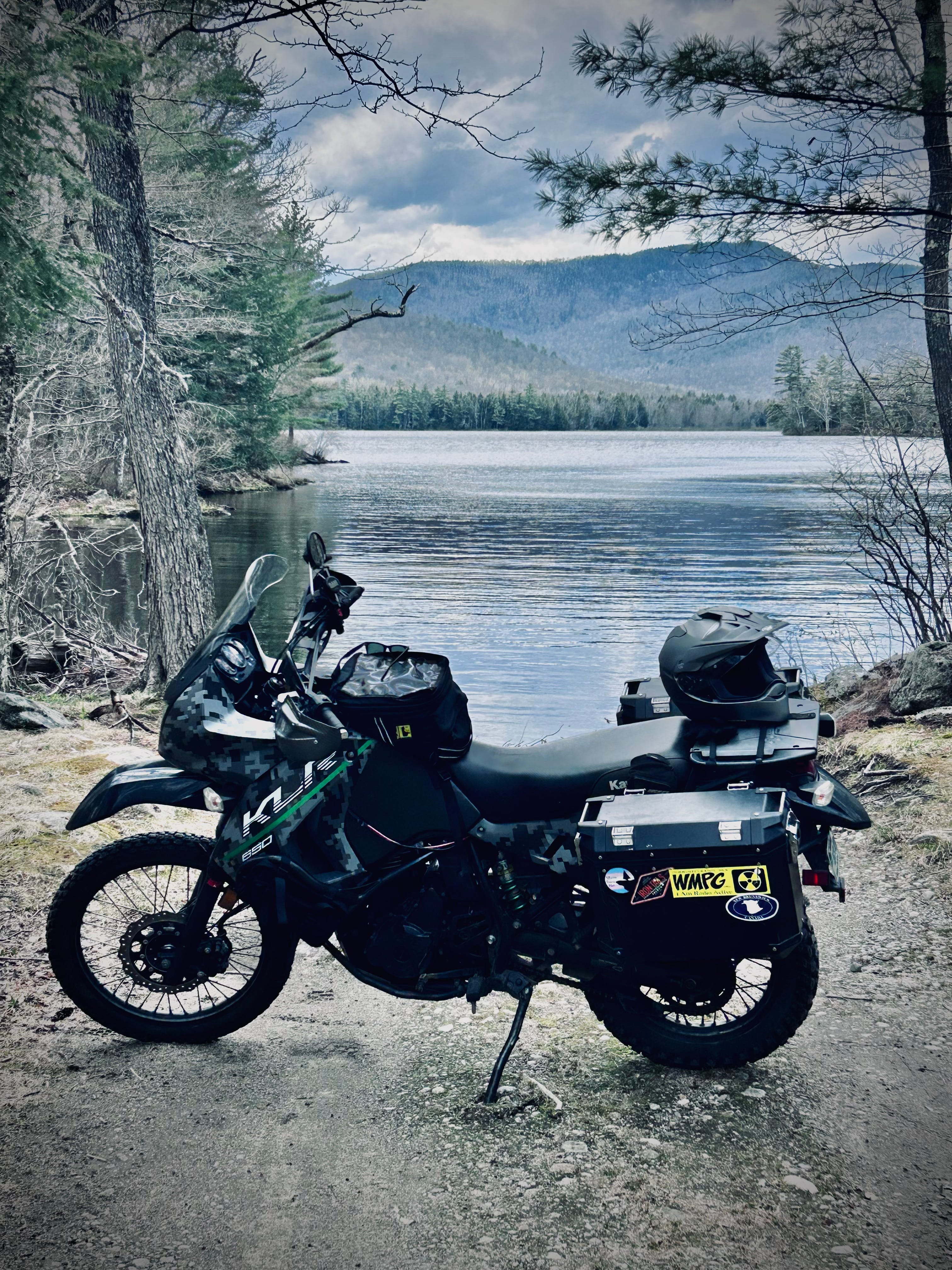
I then hopped on my bike and rode away sporting a big grin. A wonderful day followed. I found some fun dirt roads, outran a tailgating thunderstorm and sipped coffee overlooking a waterfall deep in the woods.
No GPS needed, wanted or missed.
I got there from here the old way, keeping my eyes open, my brain switched on and pulling over every so often to consult the almighty analog oracle that is my crinkled and worn Maine Atlas and Gazetteer.
As Portland Press Herald reporter Ray Routhier recently pointed out in a story, this year marks the venerable, 70-page map’s 50th birthday. David Delorme first published it in 1976 and it’s been guiding Mainers around their home state for half a century now. More than a detailed, visual representation of the state’s road system, it also describes the geology, trails, canoe routes, campgrounds and historic sites that make Maine, Maine.
As I wrote in a song about the Gazetteer a few years ago when (ironically!) Garmin bought Delorme’s map company, “It’s the thing that tells us just who and where we are and it’s waiting for adventure in the back of your friggin’ car.”
Or motorcycle saddlebag, in this case.

I guess I’s forgotten my own song, succumbing to the mind-numbing allure of a life made more nimble, sexy and controllable through advanced technology delivered through yet another goddamned screen. Instead of any of that, Garmin delivered an expensive, fragile piece of often non-functioning hardware powered by baffling, outdated software, both of which made my life much worse.
I’d hoped the Garmin XT GPS, specially made for motorcycles, would help me map out pre-planned backroads adventures dreamed up during Maine’s long winters. But the software bundle appears like it was last updated sometime in the early 90s on a Commodore 64 computer. It’s completely non-intuitive and frustrating beyond belief. The updates never worked properly and the Mac version produced the “spinning wheel of death” with every supposedly simple task.
I don’t want to go into too many details but I spent nearly three hours Monday night (using my Gazetteer for reference) plotting out waypoints along a series of roads which clearly made a 200-mile loop to and from Portland. But, when I told the software to plot the route, it made a confusing set of criss-crossing curlicues, hitting each waypoint in a random series of backtracks resembling a Jackson Pollack painting. I had to manually straighten the whole thing out using the software’s crude pointer tool.
A highlighter pen on a piece of paper would have been 100 percent more efficient.
Meanwhile, I’d had nothing but trouble with the GPS unit itself since buying it four years ago. It snapped into a powered cradle on my handlebars and, starting the summer I bought it, would power itself off at random intervals, usually right before a crucial turn. I asked Garmin for help but they just advised I get a new cradle, which I did. That did nothing. Internet forums then told me to tighten the mounting bolts and shim the power cable (with a piece of paper) to try to make a better connection. Also, no dice.
Thus, when I snapped the whole thing together in my driveway Tuesday morning, the screen stayed lit just long enough to show me the route had reverted to it’s unnatural state of loops and backtracks and said my 200 mile ride would take 22 hours to complete.
That’s when I either lost my temper or finally came to my senses, depending on how you look at it.
I snatched the POS Garmin from its cradle, stomped over to the sidewalk and — whammo! — plunked it down as hard as I could. Victory was mine. I’d thrown off my 21st century technological shackles, getting back to what I really wanted and needed: A day of spring riding along Maine’s back roads, free from phones and screens, the way my grandparents did it on their bikes back in the 1940s and 1950s, just me, the wind and my tires alternately whining on asphalt, crunching on gravel.
Did I get lost a couple times? I did. It was fun and felt like an adventure. Did I have to turn around on more than one dead end road? Yep, and I bet that since I wasn’t blindly following a purple line on the screen in front of me I’ll be more likely to remember where I went and how to get back there some day.
In any case my adventure was made entirely possible by my Gazetteer. As a bonus, I met friendly people every time I pulled over and pulled out my wrinkled copy. Folks love giving directions and being helpful, even if when don’t really need it.
To end, I’ll quote my own song again, “Just gimmie a dogeared Gazetteer, maps one to seven-o. It’ll take me where I’m headed for and it’ll always get me home.”
And it did.
Just bought my updated copy for my summer trip to my other home!